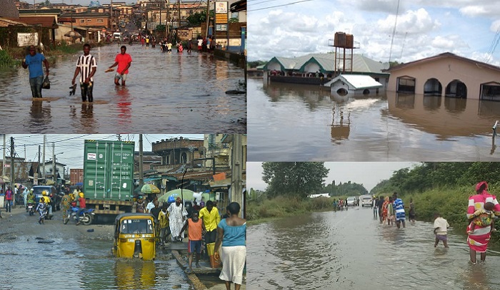
BY VICTOR BUORO – Twenty-four states and the Federal Capital Territory (FCT) are on high alert as the Federal Government issues an urgent flood warning to the residents spanning September 27 to October 10, 2026.
The warning was contained in a flood prediction issued by the National Flood Early Warning Systems Centre, a unit under the Federal Ministry of Environment’s Erosion, Flood and Coastal Zone Management Department.
Following heavy rainfall, swelling river levels, and fully saturated soil that are expected to trigger intense surface runoff across the country, an advisory signed by Department Director Usman Abdullahi Bokani, quoted officials as classifying vulnerable communities nationwide into critical, high, or moderate flood-risk zones during the specified period.
According to the alarm flag, States with communities listed in the critical-risk category include Benue, Kogi, Kwara, Niger, Adamawa, Bauchi, Taraba, Rivers, Edo, Delta, Cross River, Bayelsa, Akwa Ibom, Abia, Anambra, Ebonyi, Enugu, Imo, Ekiti, Lagos, Ogun, Ondo, Osun and Oyo.
Similarly, the forecast document put the FCT, Nasarawa, Plateau, Bauchi, Taraba, Adamawa and Kebbi states among areas where communities have been placed on the high-risk list.
The Centre further explained that the prediction was based on elevated soil moisture, expected rainfall, rapid surface runoff, drainage surcharge and rising river levels, which could combine to trigger flooding, adding that major urban centres covered by the warning include Makurdi, Lokoja, Minna, Port Harcourt, Benin City, Asaba, Calabar, Uyo, Aba, Onitsha, Enugu, Owerri, Ado-Ekiti, Lagos, Abeokuta, Akure, Osogbo and Ibadan.
In the FCT, Abuja Municipal, Asokoro, Bwari, Garki, Gwagwalada, Gwarinpa, Kubwa, Kuje, Kwali, Lugbe, Maitama, Nyanya and Wuse were among locations listed as facing high flood risk.
The Centre stated that coastal and riverine communities across Rivers, Delta, Bayelsa, Cross River, and Akwa Ibom are on high alert after being slapped with a “critical-risk” classification by the National Flood Early Warning Systems Centre.
This is as emergency officials urged residents in these vulnerable zones to launch immediate flood watches, map out definitive evacuation routes, and aggressively secure essential property, documents, and vulnerable family members.
Additionally, there are strict directive warning citizens to immediately stop settling, parking vehicles, trading, or storing inventory on floodplains, wetlands, riverbanks, and low-lying drainage corridors.
The Centre said emergency agencies, local officials, and community monitors must immediately step up surveillance of rivers, dams, and erosion-prone areas, adding that for communities designated as high-risk zones, the relevant authorities must undertake immediate actions such as clearing all blocked drainages and critical waterways; Monitoring local culverts continuously for blockages; and Reporting heavy rainfall, sudden ponding, dam releases, or rising river levels instantly to emergency channels.
Warning that even areas on the moderate-risk watch-list must maintain high vigilance, the Centre said consecutive days of prolonged rainfall could rapidly trigger flash floods, adding, “to prevent loss of life, residents are strongly urged to take immediate safety precautions: Comply with evacuation orders from local authorities without delay; Keep children away from dangerous floodwaters; and Never walk or drive through moving water.”
The Centre’s practical, and urgent checklist for survival also includes the following: disconnect power before the water hits, pack up life-saving medications, and safeguard irreplaceable documents alongside food and clean water.
However, noting that a static forecast only tells part of the story, the Centre stressed the need for residents to always look out from their own windows, tracking real-time rainfall and swelling river banks while staying tuned to local evacuation orders.
The Centre added that behind the scenes, observations should cover the disaster response framework which relies on a living network, using a steady stream of field reports from state authorities and community leaders to continuously update the region’s flood-risk database.